Sharp Peak Hike, Hong Kong: The Complete Trail Guide
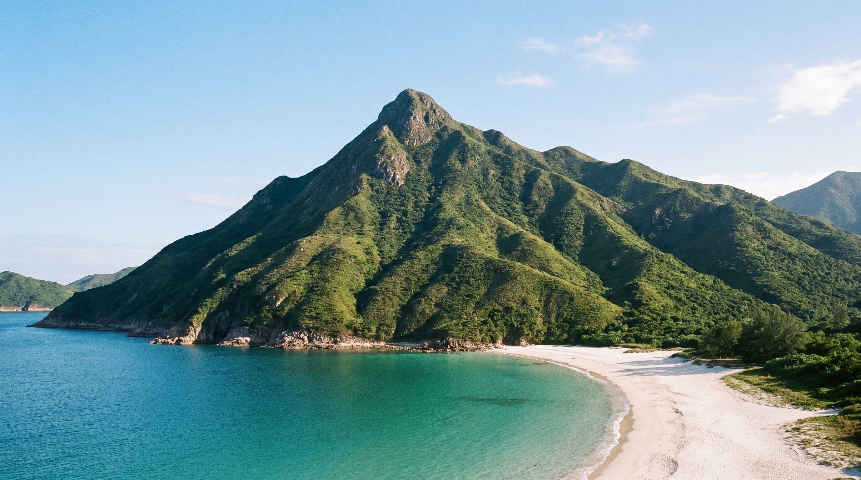
The Sharp Peak hike in Hong Kong, also known as Nam She Tsim (蚺蛇尖), climbs the 468-metre summit that gives Sai Kung East Country Park its most recognisable silhouette, and it's one of the hardest day hikes in the territory. This isn't Dragon's Back with better scenery: the final approach to the summit is a hands-and-feet scramble over loose rock and sandy dirt, with nothing to grab onto but the terrain itself. Here's how to get to the trailhead, what the route actually demands, and what you need to bring to do it safely.
How to get to the trailhead
Take the MTR Tseung Kwan O Line to Hang Hau station and leave via Exit B1. From there, board green minibus 101M to Sai Kung Waterfront Park. At the Sai Kung bus terminus, catch bus 94 to Pak Tam Au, which is the standard starting point; bus 96R covers the same route but only runs on weekends and public holidays. Pak Tam Au has a public toilet and vending machines, which is the last reliable water source until you're back off the mountain.
Distance, elevation and how hard it really is
The full loop from Pak Tam Au runs roughly 14.5 to 15km and takes 6 to 7 hours with around 650m of total elevation gain across the undulating ridgeline, not just the climb to the 468m summit itself. There's a shorter way in: a speedboat from Sai Kung Pier to Ham Tin Wan (roughly HK$120 to 160, about 30 minutes) cuts the walking down to about 7km and 3 hours round trip. Either way, this is rated as one of the harder hikes in the territory, not a casual walk: expect steep, loose underfoot conditions on unshaded ridgeline, especially on the final ascent.
The route, and the scramble at the end
From Pak Tam Au the trail crosses a series of ridges, drops to Sheung Luk Stream and the rock pools nearby, then continues along the coast past Ham Tin Beach on the MacLehose Trail Section 2 to Tai Wan Beach. From Tai Wan, the trail turns inland and climbs steeply to the summit. The last stretch is the part that earns Sharp Peak its reputation: sandy dirt and loose stone with little to hold onto, sections where you'll use your hands as much as your feet, and low, thorny brush that will find any bare skin. Descending is harder than climbing up, since the same loose footing works against you with gravity added in. None of it requires ropes or climbing gear, but it does require care on every step, not just the tricky-looking ones.
What to bring
Gloves help on the scramble sections, where you're using your hands on rock and dirt. Bring more water than you think you need: the restaurants along Ham Tin Beach aren't guaranteed to be open, there's no tap past Pak Tam Au, and there's no shade once you're on the exposed ridge. Trousers rather than shorts are worth it for the thorny brush near the summit. Go in winter or on a cool, dry day if you can arrange it: wet rock on this route turns a hard hike into a genuinely dangerous one, and mobile signal is patchy around Sai Wan Pavilion if something goes wrong. This is not a hike for young kids, and most guides don't recommend bringing a dog either.
Getting back down
You've got three realistic ways off the mountain. Retrace your steps to Pak Tam Au for the bus back the way you came. Continue along MacLehose Section 2 to Sai Wan Pavilion, where green minibus NR29 runs to Sai Kung Town (taxis also wait here, though signal to book one can be unreliable). Or, if you arranged the speedboat approach, take it back out from Ham Tin Wan or the Chek Keng pier rather than walking out the way you came. If Sharp Peak sounds like too much for the day you've got, Dragon's Back covers similar coastal ridge scenery on a graded path with no scrambling, and the free hiking routes up to Victoria Peak without the tram are an easier city-side alternative. Lantau Peak is the other big Hong Kong summit hike, tough but without the hands-on-rock finish. Either way you're travelling out, Sai Kung is worth building into a full day; see our Sai Kung day trip guide for what else to do in the area.
Quick answers
What is the sharpest peak in Hong Kong? Sharp Peak (Nam She Tsim) is generally the one people mean: Wikipedia notes it's particularly known for its well-defined, pointed summit, and it's grouped with two other Sai Kung hills as the "Three Sharp Peaks."
How long does it take to hike to Sharp Peak? The full loop from Pak Tam Au is 6 to 7 hours over roughly 14.5 to 15km. Approaching by speedboat to Ham Tin Wan cuts that to about 3 hours and 7km round trip.
What is the hardest hike in Hong Kong? Sharp Peak is consistently named among the hardest, largely because of the loose-rock scramble on the final ascent, rather than distance or elevation alone.
What is the best hike in Sai Kung? Sharp Peak is one of the most scenic, with Tai Long Wan's beaches visible for most of the route, but it's a serious hike, not a casual one; if you want Sai Kung's coastline without the scramble, the MacLehose Trail Section 2 coastal sections it shares are gentler on their own.