Violet Hill & the Twins Hike: Wong Nai Chung Gap to Stanley, Step by Step
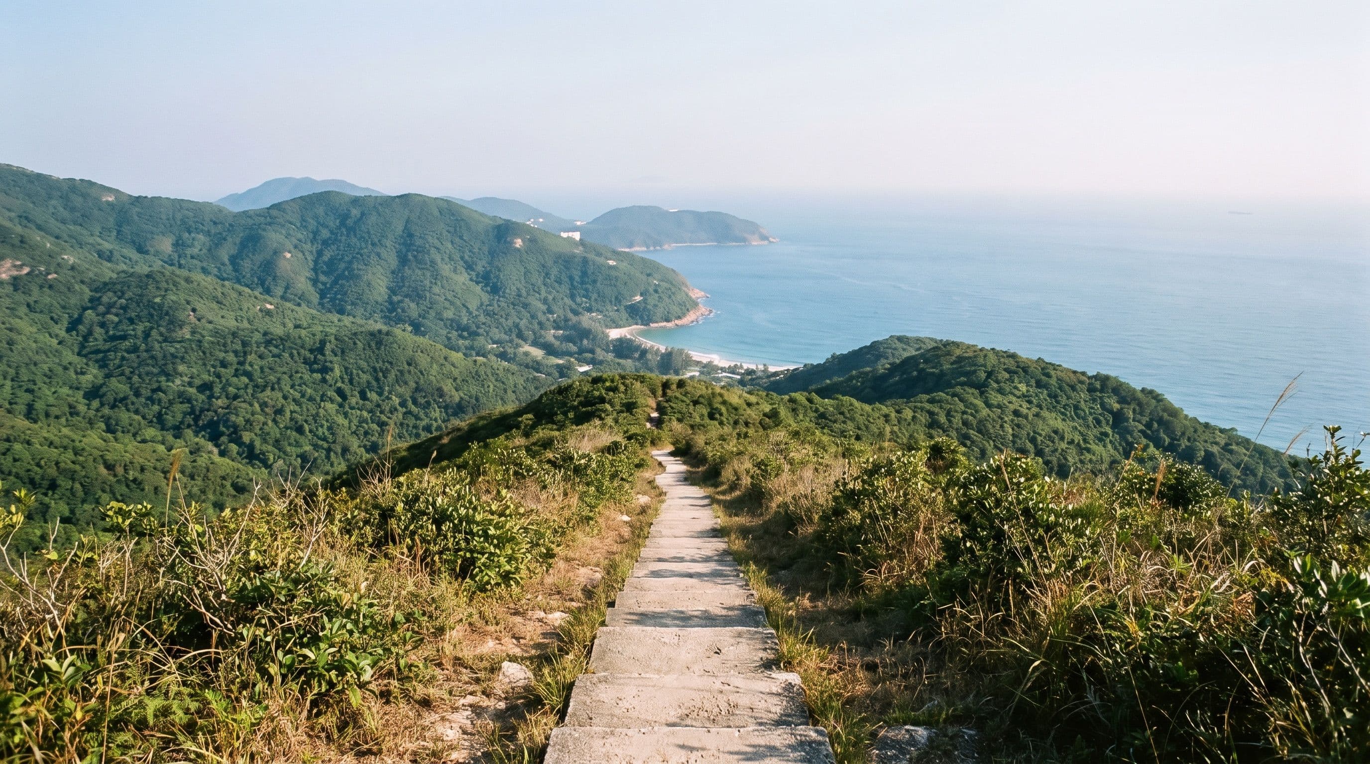
The Twins hike via Violet Hill is, by reputation and by step count, one of the hardest hikes on Hong Kong Island, and most of the difficulty is one staircase. You climb Violet Hill from Wong Nai Chung Gap, drop into the valley above Repulse Bay, then go straight up the Twins on a flight of steps the hiking blogs count at 1,000 to 1,200. It is under 5 km and takes most people two and a half to three and a half hours. Here is the route step by step, what the summits actually look like, which buses really stop at each end, and where to bail out.
Twins hike via Violet Hill: the route in numbers
This is Wilson Trail Section 1 walked in reverse. The official section runs from Stanley Gap Road over the Twins, across Tze Kong Bridge about 2.2 km in, over Violet Hill and down to Tai Tam Reservoir Road. Most people walk it north to south so the day ends in Stanley.
- Distance: 4.7 to 4.8 km on the GPS tracks published by Hiker Hero and Drone and SLR. Journey Era logged 5.7 km starting from Stanley with detours.
- Climbing: about 390 to 400 m of ascent north to south. The bus stop at Wong Nai Chung Gap sits around 200 m above sea level, Violet Hill tops out at 436 m, the valley at Tze Kong Bridge is about 140 m, and the Twins are 363 m (north) and 386 m (south) before the trail ends at roughly 100 m on Stanley Gap Road.
- Time: Hiker Hero took 2.5 hours; Journey Era 2 hours moving and 3 in total with photo stops. Budget three and a half if you are not a regular hiker.
- Surface: mostly concrete steps, with a stretch of dirt and rock between the two hills. Nothing technical or exposed, just relentless stairs.
Getting to the start at Wong Nai Chung Gap
There is no MTR near either end, so this is a bus hike. From Central, Citybus route 6 leaves Exchange Square bus terminus (walk out of MTR Hong Kong Station via Exit D) with Stanley on the front, picks up at Admiralty, climbs Stubbs Road and stops at Wong Nai Chung Reservoir Park on Wong Nai Chung Gap Road. The full Central to Stanley fare is HK$11.4 per the Transport Department route data, and the gap is roughly 15 minutes from Admiralty on a quiet morning. From Causeway Bay or North Point, route 63 stops at the same place.
There is a Sinopec petrol station at the junction, and it is the last place to buy water or food until Stanley. Follow the signs for Parkview up Tai Tam Reservoir Road, past the small Wong Nai Chung Reservoir, and after about ten minutes of uphill road the trailhead is on the right: a flight of steps with a Wilson Trail sign, just before the Hong Kong Parkview towers. The hill behind the reservoir is Violet Hill.
Part one: up Violet Hill
The first climb is steps from the start, with a short flat stretch alongside a chain-link fence, then more steps. It is steep but it is the shorter of the two climbs, roughly 230 m of ascent from the bus stop, and it eases into a dirt path near the ridge. Partway up, look back north over Parkview and you can see through the gap between the hills to Kowloon and the ICC tower.
Violet Hill's Chinese name means violet flower hill, and the Hong Kong iris, a protected violet-flowered plant, grows on its slopes. The summit itself is a trig point surrounded by shrubs with little to see. Do not stop there. The viewpoint is two minutes further on, and the real reward is the ridge beyond it: for the next 1.5 km the trail runs gently downhill in the open, with Tai Tam Country Park and its reservoirs on the left and Repulse Bay and the South China Sea on the right. This is the best walking of the day, and there is no shade on it.
Tze Kong Bridge: the decision point
The ridge ends with a long flight of steps down into Repulse Bay Gap, where a small bridge, Tze Kong Bridge, crosses a concrete water channel. From the north end you have now done the easier half. From here the trail goes straight up the Twins, and people sit on the bridge for longer than they need to for exactly that reason.
This is also your only bailout. A path follows the channel downhill for about 700 m to Repulse Bay Road, coming out near the Repulse Bay Towers bus stop, on a road the 6, 63, 65, 73 and 260 all run along in both directions. Another 300 m or so on foot brings you down to Repulse Bay beach and its cafes. If you only wanted Violet Hill, this is a perfectly good finish, and it matches the Violet Hill-only route on AllTrails (3 km, 255 m of gain, 1.5 to 2 hours).
Part two: the steps up the Twins
From the bridge the trail climbs around 220 m to the north Twin in about 500 m of distance, and almost all of it is stairs. Hiker Hero measured sections at a 60 percent gradient. The steps are enclosed in dense bush for most of the climb, so there is no view to distract you, just the steps behind and the steps ahead. Pace yourself, stop when you need to, and expect to be passed by trail runners coming down.
Here is the part the "epic views" headlines leave out. The north Twin summit is a small rocky clearing surrounded by bush with no view at all. A short dip and a gentler climb brings you to the south Twin, the higher of the two at 386 m, where the summit is a bench and more bush. Hiker Hero's account is blunt about this. You do not climb the Twins for the top. The stairs are the point, and the views come back on the way down.
The descent to Stanley Gap Road
Leaving the south Twin the bush opens up and the whole descent faces Stanley: the bay, the village and the peninsula laid out below you. There is a marked viewing platform (Ma Kong Shan, the Twins' official name) partway down, and this is the stretch Journey Era regrets not walking at sunset. Start mid-afternoon in winter and you can time it that way.
The steps down are still steep but less brutal than the climb. The trail ends at Stanley Gap Road, next to a bus stop and a Tai Tam Country Park sign.
Which bus to take from the end (the 6 does not stop here)
Most guides tell you to catch bus 6 from the Stanley Gap Road stop. According to the Citybus route data it does not call there: both the 6 and the 6X run between Repulse Bay and Stanley via Chung Hom Kok Road, not Stanley Gap Road. The stop at the trail end is named Wilson Trail, Stanley Gap Road, and the routes that serve it are the 260 (Stanley to Central Exchange Square, HK$15.1 full fare) and the 73 (Stanley to Cyberport via Repulse Bay, HK$8).
If you want the 6 back to Central, or lunch first, walk down into Stanley instead: about 15 minutes on foot to Stanley Plaza, with Stanley Market, the waterfront and every Stanley bus route right there.
When to go, and what to bring
October to March is the season. The ridge and the Twins have almost no shade, the steps get slippery after rain, and summer humidity turns this from hard to dangerous. Hiker Hero walked it on a January Friday morning and passed four people between Parkview and Stanley; weekends are busier and the buses fill up, so go early.
There is no water and no shop between the petrol station at Wong Nai Chung Gap and Stanley, so carry more than the distance suggests. Shoes with grip matter most, because the surface is almost entirely concrete steps and your knees will feel every one.
Is it the right hike for you?
If this is your first Hong Kong hike, it should not be. Dragon's Back gives you the same south-coast views for a fraction of the climbing, and the routes in our best hiking trails with a view roundup are better next steps. Do Violet Hill alone via the Repulse Bay bailout if you want the scenery without the suffering, and the full Twins if you want the workout, the near-empty trail and a well-earned bowl of wonton noodles in Stanley.
Quick answers
- Is the Violet Hill hike hard? Violet Hill on its own is a moderate climb of about 230 m on steps, 1.5 to 2 hours to the bailout at Repulse Bay. The Twins are what make the full route hard: a second climb of around 220 m on roughly 1,000 to 1,200 consecutive steps.
- How long is the Violet Hill hike? The full Violet Hill and Twins route from Wong Nai Chung Gap to Stanley Gap Road is 4.7 to 4.8 km. Allow 2.5 to 3.5 hours. Violet Hill alone, finishing at Repulse Bay, is about 3 km.
- How long does it take to hike the Twins? From Tze Kong Bridge it is about 220 m of climbing on steps to the north Twin, a short dip to the south Twin, then the descent to Stanley Gap Road: half the route's distance and more than half its effort.
- Where does the hike start? At the Wilson Trail steps on Tai Tam Reservoir Road just below Hong Kong Parkview, a ten-minute walk up from the Wong Nai Chung Reservoir Park bus stop (routes 6 and 63). You can also start at the Wilson Trail stop on Stanley Gap Road (routes 260 and 73) and walk it south to north.
- Can you skip the Twins? Yes. At Tze Kong Bridge follow the water channel downhill for about 700 m to Repulse Bay Road and the Repulse Bay Towers bus stop.